
The Sankeythèque
Real studies built with OpenSankey and MFASankey for public agencies, research projects and sector organisations. Every diagram here started as messy, incomplete data.
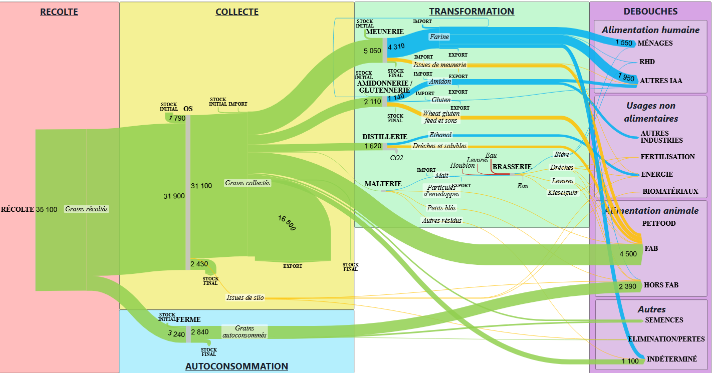
Agricultural supply chains: SOCLE project
2025–2027
SOCLE (ADEME) extends RefFlux: building, over several years, a base platform for modelling French agricultural supply chains — production, processing and trade combined into reconciled mass balances, updated as annual data comes in.
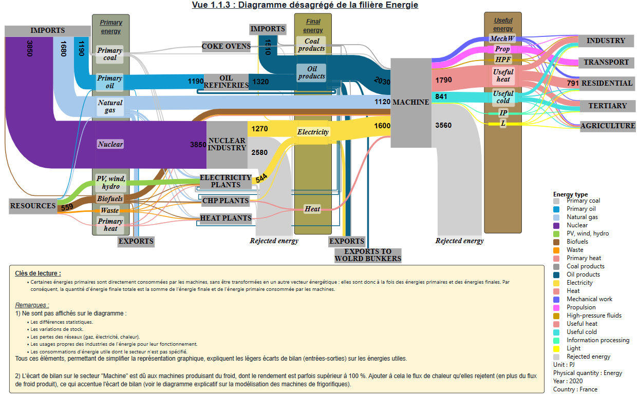
Energy flows in France: Metabol'Heat project
2025–2026
Half of France's final energy consumption goes to thermal uses — yet heat flows remain the least well described part of the energy system. For the CNRS Environnement Ville Société laboratory's ANR project Metabol'Heat, this national map follows energy from primary supply to end uses, useful and dissipated heat included.
WooDyn: transition MFA and LCA of the forest-wood sector
2025–2026
From snapshot to motion picture: the ADEME GRAINE WooDyn project (coordinated by Université Gustave Eiffel, with CSTB, IFPEN, INRAE, Inria STEEP, FCBA and TerriFlux) makes material flow analysis of the forest-wood chain dynamic — stocks, lifetimes, product cohorts — and couples it with a "transition" LCA that reasons in systems rather than products.
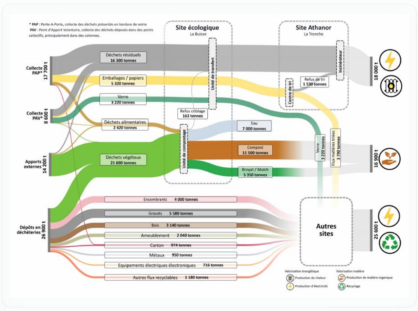
Waste flows of the Pays Voironnais
2024–2026
What becomes of a territory's waste once it has been collected? For the waste management department of the Pays Voironnais urban community — 31 municipalities, 95,600 inhabitants, an in-house service handling more than 53,000 tonnes a year — this publication retraces three stages of a single journey. First a demonstration: the "flows" double page of the annual report, a process diagram whose links all have the same thickness, turned into a Sankey where proportions are finally carried by the drawing. Then an interactive map, commissioned in 2024, whose single flow graph reads from four angles — geographical destination, collection mode, waste type, and the crossing of the last two.
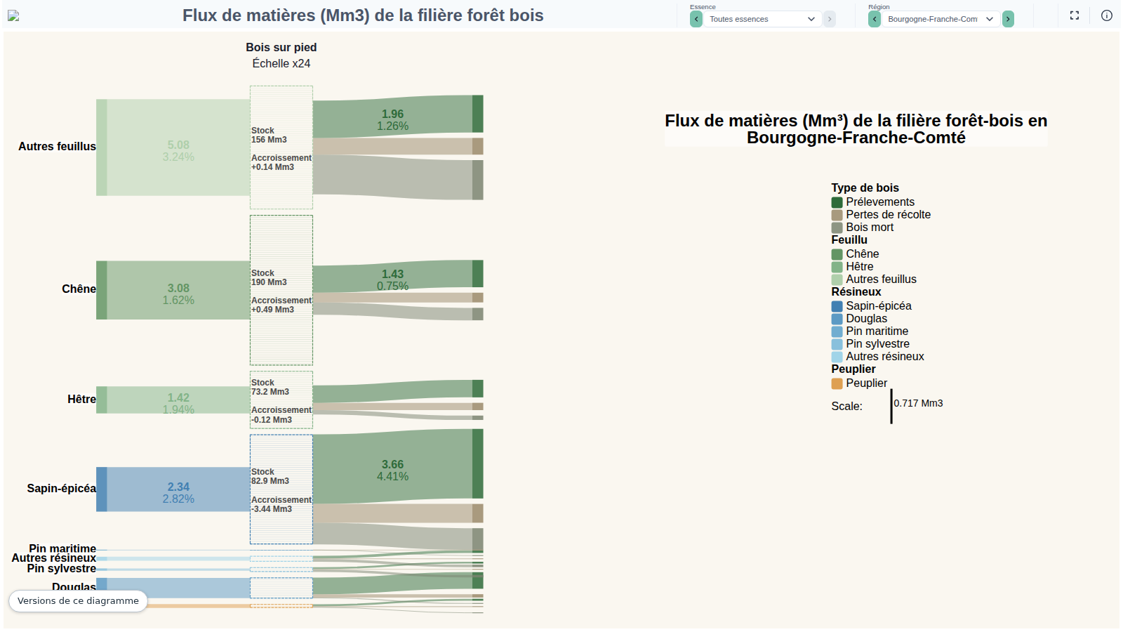
CARTOFOB: forest-wood flows of the French regions
2023–2026 · IGN
The IGN's CartoFob portal publishes forest biomass indicator by indicator: standing volume, biological production, removals, mortality, harvest, sawnwood, by-products. This diagram gathers them into a single picture — from standing timber to end uses — for the thirteen regions of mainland France and twelve species views.
Forest-wood flows: BACCFIRE project
2023–2025
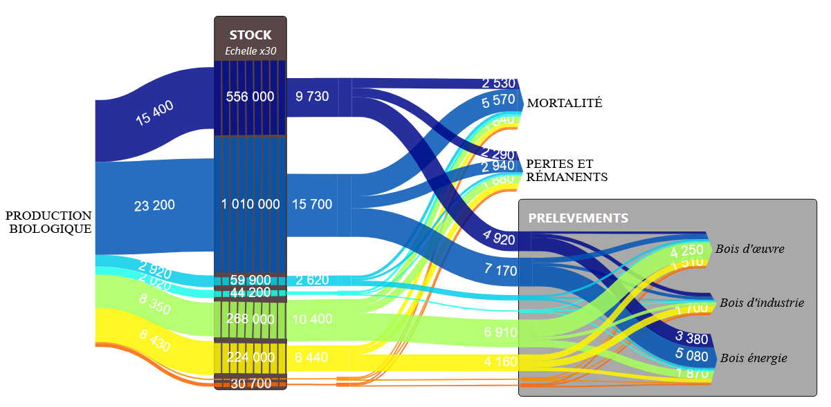
Four years of work on the fate of carbon along the flows of the French forest-wood chain: the BACCFIRE project (ADEME GRAINE, coordinated by the ONF) consolidates the methods for assessing wood's three climate effects — forest sequestration, storage in products, substitution of more emitting energy and materials.
Material flows of the French pig sector
2022–2025
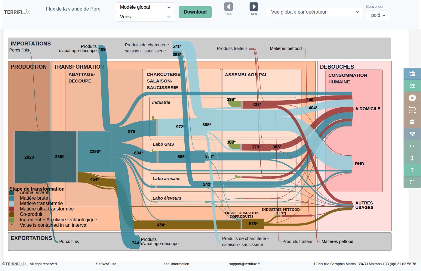
Where do the cuts of a French pig actually go? Under a FranceAgriMer contract co-funded by the INAPORC interbranch organisation, IFIP (the French pork institute), supported by TerriFlux, mapped the entire supply chain — from farms to slaughter, cutting, processing, consumption and foreign trade — by reconciling customs statistics, consumer panels and slaughterhouse data that never agree of their own accord.
Agri-food chain coefficients repository (Scalable)
2020–2025
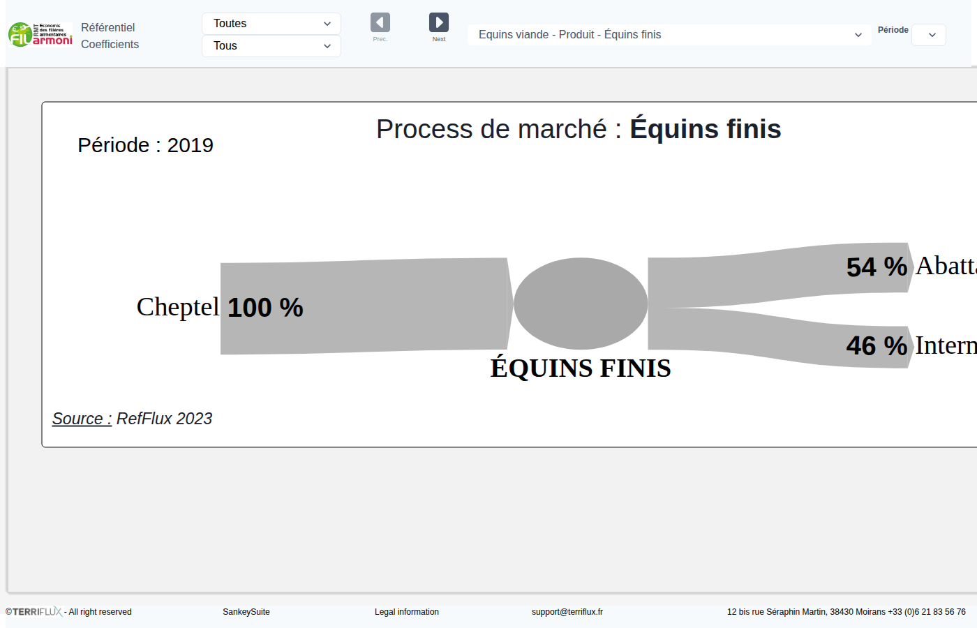
How much flour in a quintal of wheat, how much milk in a tonne of cheese? The ADEME Scalable project (coordinated by INRAE LESSEM, with Inria STEEP, AURA-EE and TerriFlux) built a shared reference base of technical coefficients for agricultural and food chains — the raw material of any flow analysis.
Construction waste and biowaste in the Grenoble conurbation
2019–2025
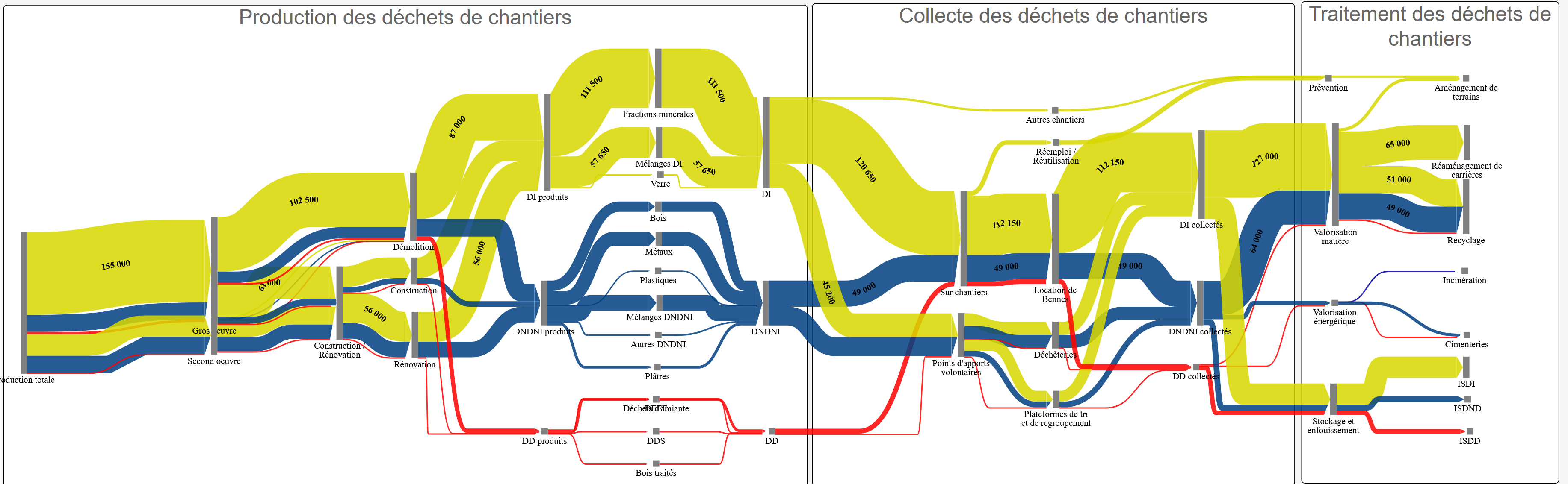
Four diagrams follow two waste families of Grenoble Alpes Métropole, from production to final outlet. Construction waste first — production by sector and type of operation, then by regulatory category; collection by capture mode; treatment split between material recovery, energy recovery and landfill — with a second diagram unfolding the same chain material by material, and telling collected data apart from data reconstructed by reconciliation. Biowaste next, as a cascade of resource pools down to the anaerobic digestion plant, making visible the losses nobody publishes: prevention, home composting, inaccessible pools, sorting errors.
Straw flows in Bourgogne-Franche-Comté
2024
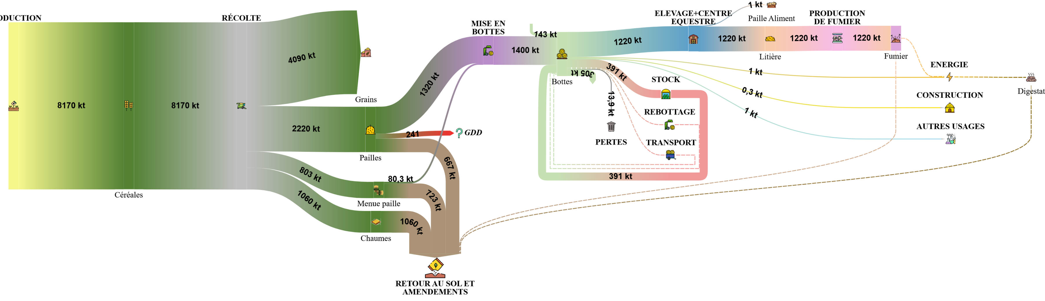
Where does the straw go? For ADEME Bourgogne-Franche-Comté, the study quantifies regional production and its uses — return to soil, bedding, livestock, construction, energy, exports — from stakeholder interviews and agricultural statistics, over a four-month study.
The Beaufort cheese supply chain
2024
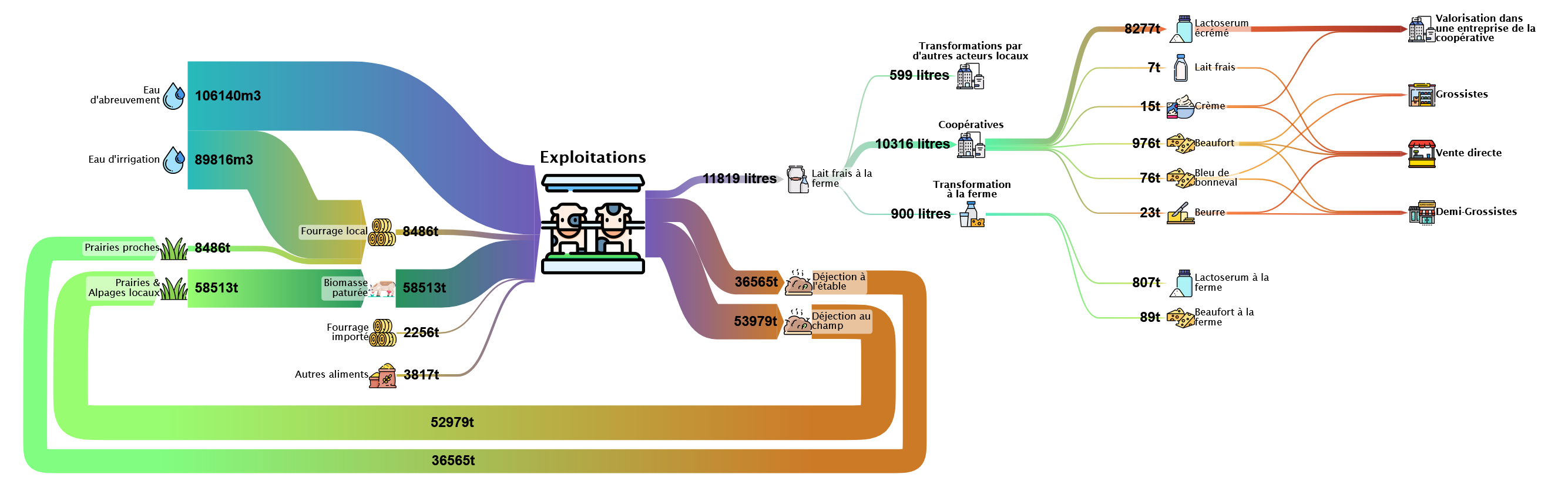
From alpine pastures to the market stall: the Beaufort PDO cheese chain of the Maurienne valley, mapped as part of Michela Bevione's PhD (Inria STEEP × PACTE) on territorial metabolism and wealth creation. Milk, feed, co-products: the physical flows of the valley's three cooperatives, crossed with the sector's economic and social dimensions.
Prospective flows of the French wood industry (Carbone 4)
2023–2024 · Carbone 4
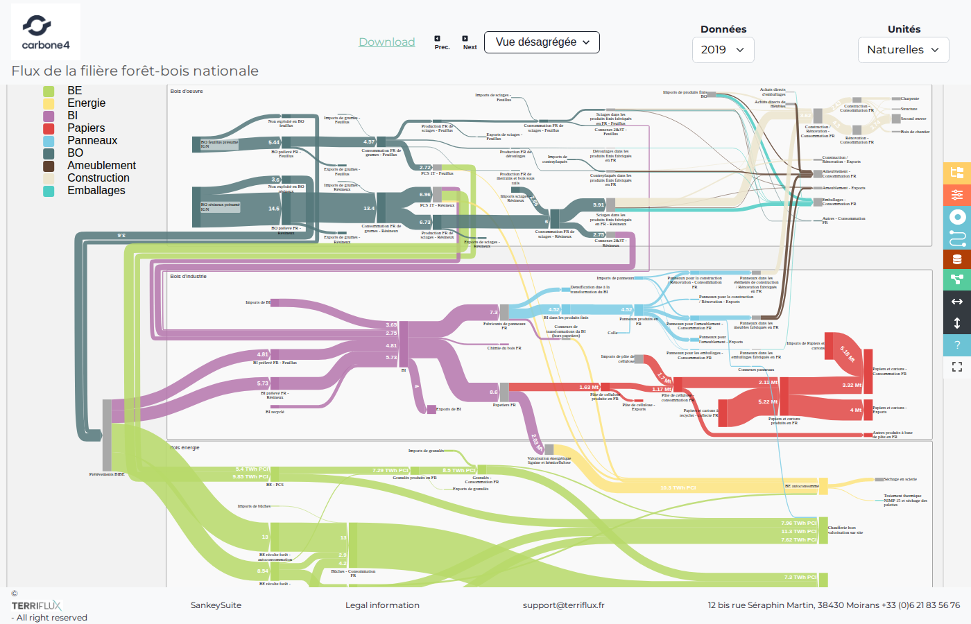
In support of the Carbone 4 consultancy's foresight work on the French forest-wood chain, TerriFlux reconciled and rendered the sector's flows for three horizons — current situation, 2030, 2050 — from the study's data.
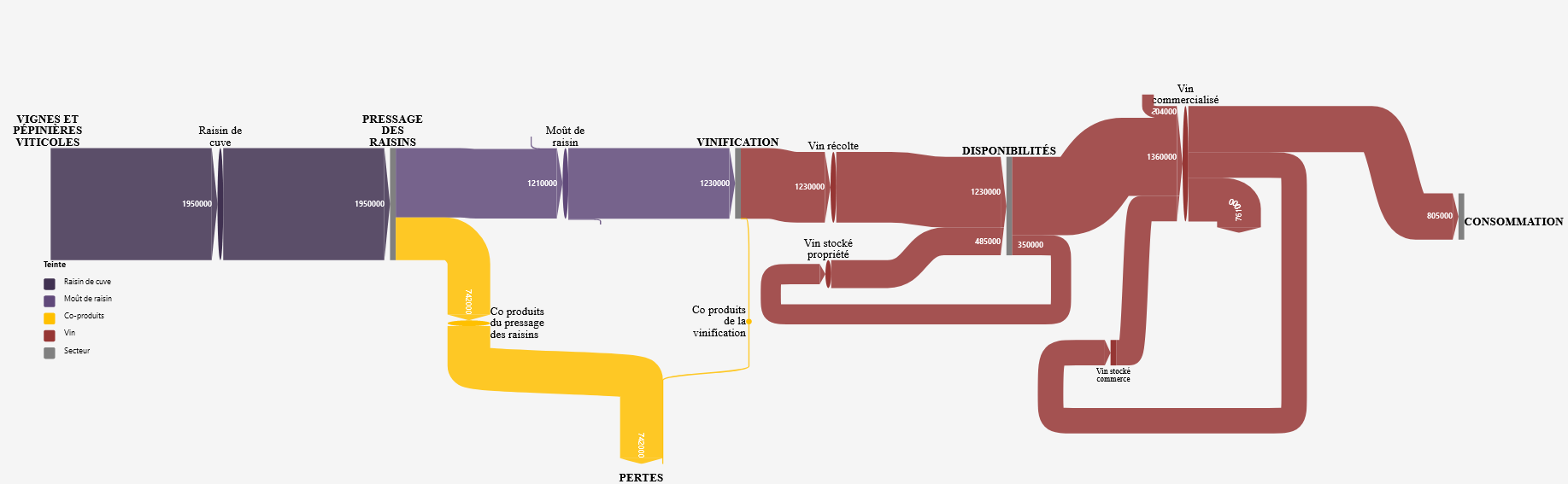
Regional food systems: AURA, Occitanie, Normandie
2023
Three regions, one reading grid: these comparable maps follow regional food systems from agricultural production to consumption, through processing and trade — a way to objectify dependencies and margins of food autonomy.
Biomass resources in Hauts-de-France
2023
The ORBE observatory (Agro-Transfert Ressources et Territoires, the regional chamber of agriculture, UniLaSalle, La Coopération Agricole, Bioeconomy For Change, backed by the Hauts-de-France Region and ADEME) wanted an objective picture of regional biomass resources and their competing uses. Four value chains were mapped: fibre flax, starch, rapeseed and sugar.
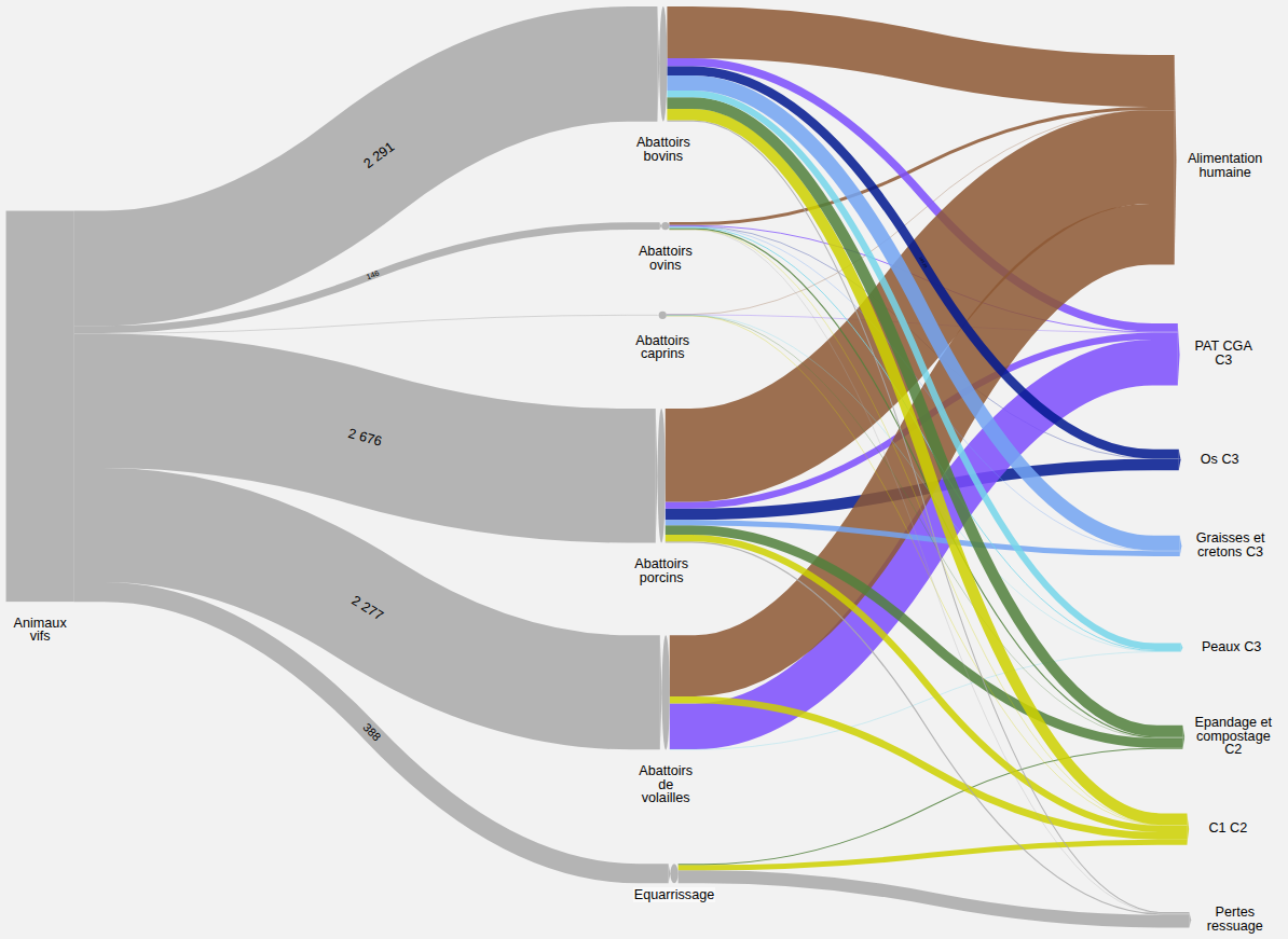
Co-products and by-products of the livestock sectors
2023
What becomes of animals beyond meat? For 2023, this diagram follows live slaughter tonnages of ruminants and monogastrics, then the products and co-products from processing and rendering — through to human food, land spreading or industrial use.
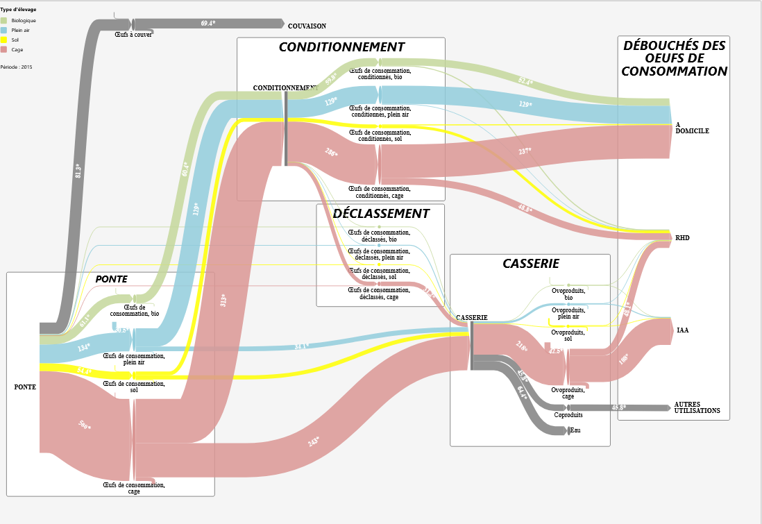
Agricultural sector flows: RefFlux project
2022–2023
Seven agricultural technical institutes, one shared need: reference flow diagrams that can be compared across sectors. In the ADEME-funded RefFlux project — coordinated by TerriFlux with the FILARMONI network — some 1,200 data points collected from field to plate were turned into 19,000 reconciled flows, produced by a fully reproducible pipeline: data in on one side, diagram out on the other.
The forest-wood industry in Grand Est
2022
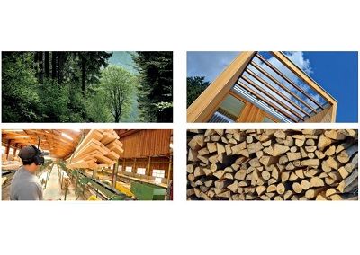
At the request of the regional agriculture authority (DRAAF) and the national biomass resources observatory, the forest-wood chain of Grand Est — France's leading hardwood forestry region — was mapped from standing resource to end uses: harvest, sawnwood, panels, paper and energy wood, including interregional and international trade.
Forest-wood flows in the Savoie regions
2022
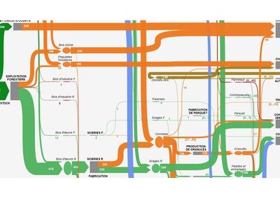
For the Pays de Savoie wood cluster (Pôle Excellence Bois), this map follows wood from the mountain forests of the two Savoie departments through to local processing and energy recovery — nine thematic views, per-use icons, and trade with neighbouring territories.
Energy and material valuation of the forest-wood sector (VEM)
2022
The energy-and-material valuation (VEM) of the French forest-wood sector, visualised as a Sankey diagram: material followed from the forest resource through to its end uses, energy and materials alike, in a single flow scheme. Arrow thickness is proportional to quantities — the split between energy and material valuation can be read at a glance.
A biophysical description of the French economy
2021
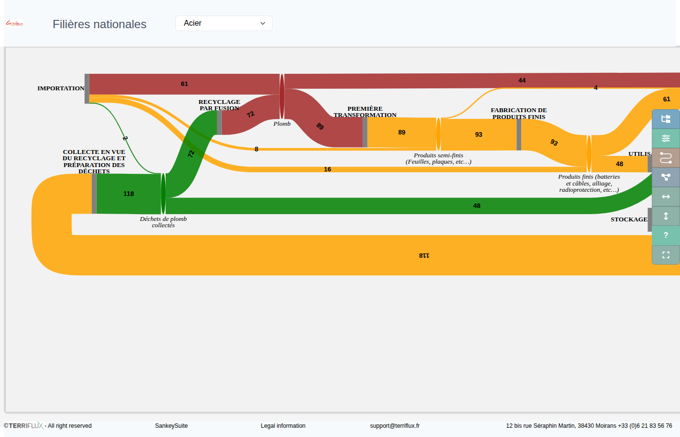
Nine material and energy chains — non-metallic minerals, waste, water, energy, fossil fuels, steel, aluminium, lead, copper — assembled into a consistent biophysical account of the French economy. A research work by Emmanuel Krieger (STEEP team, Inria), whose diagrams TerriFlux hosts and renders.
Energy flows of the Briançonnais
2019–2021 · données
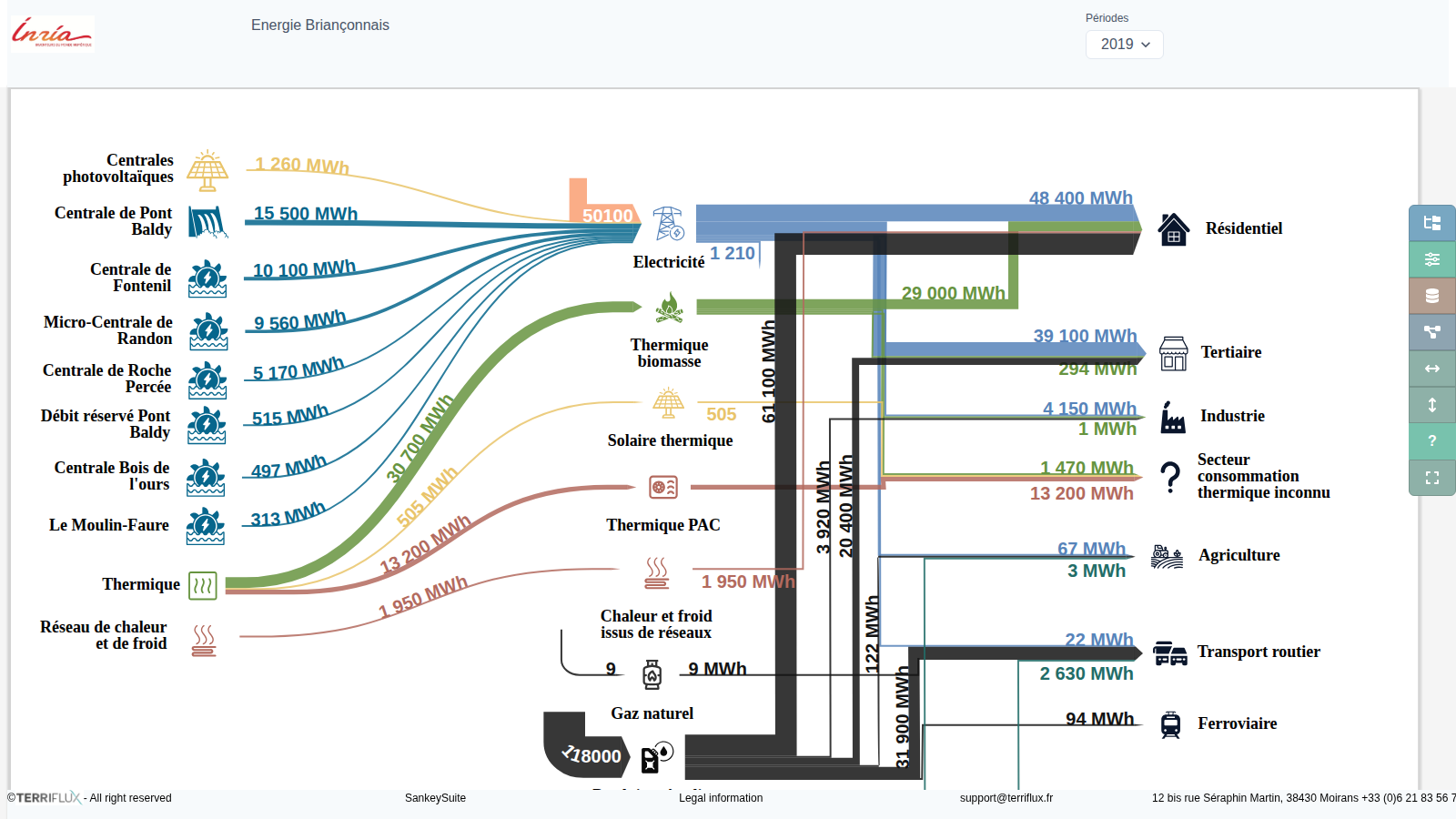
An energy balance for a mountain territory, down to the individual installation. On the left, local production: the hydroelectric plants of Briançon named one by one, and the photovoltaic arrays on the town's own facilities, from the skatepark to the ice rink. In the middle, the carriers: electricity, biomass heat and fuelwood, heat pumps, solar thermal, heating and cooling networks, petroleum products, natural gas, biofuels. On the right, end uses, from services and industry to agriculture and road and rail transport.
Raw materials for animal feed: GIS Avenir Élevages
2018
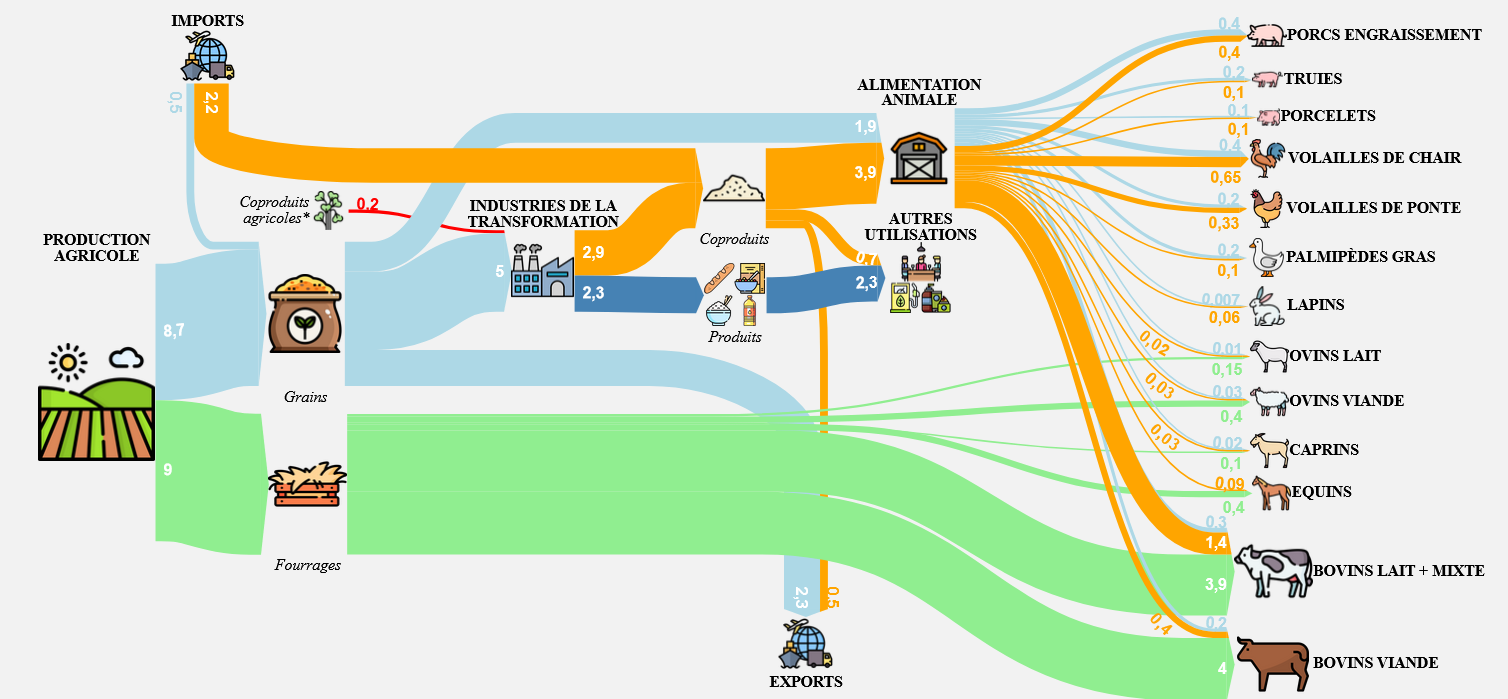
What do French farm animals eat? For the GIS Avenir Élevages consortium (INRA, CNIEL, FranceAgriMer, Terres Univia, APCA), this national map allocates domestic crops, agri-food co-products and imports across the livestock sectors — cattle, pigs, poultry — distinguishing on-farm use, direct purchases and compound feed manufacturing.